
Forge and CapeNature: What is a digital mapping partner and why is it important?
We’ve all experienced it before: You arrive at your holiday destination and upon checking in, you receive a map of the area and camp layout. Only it is so difficult to follow because it is a generations-old photocopy of a photocopy…of a photocopy. That poor photocopier! Of course, this doesn’t happen at CapeNature reserves where you receive a colourful and insightful map because they know that accurate and appealing maps are an essential guide and priority for visitors, particularly at nature reserves.
Forge has been CapeNature’s official digital mapping partner since 2021, and we’ve been working together since to make your stay at CapeNature reserves as enjoyable, insightful, and safe as possible. Going way beyond the poor, old, photocopied map, digital maps are a powerful tool. But what value do you, as a CapeNature visitor, get through our digital mapping partnership with CapeNature?
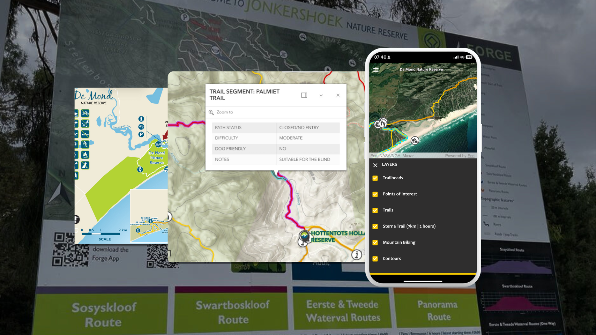
Accurate maps that are updated continuously and include instant updates on closures
Unlike most other more popular hiking apps that cover South Africa, Forge maps are not based purely on crowdsourced Open Street Maps (OSM) - which is basically the Wikipedia of mapping. Rather, we create and maintain the trails and points of interest ourselves using numerous sources, including conversations with local trail managers. The beauty of our hand-curated digital maps is that we can update them instantly.
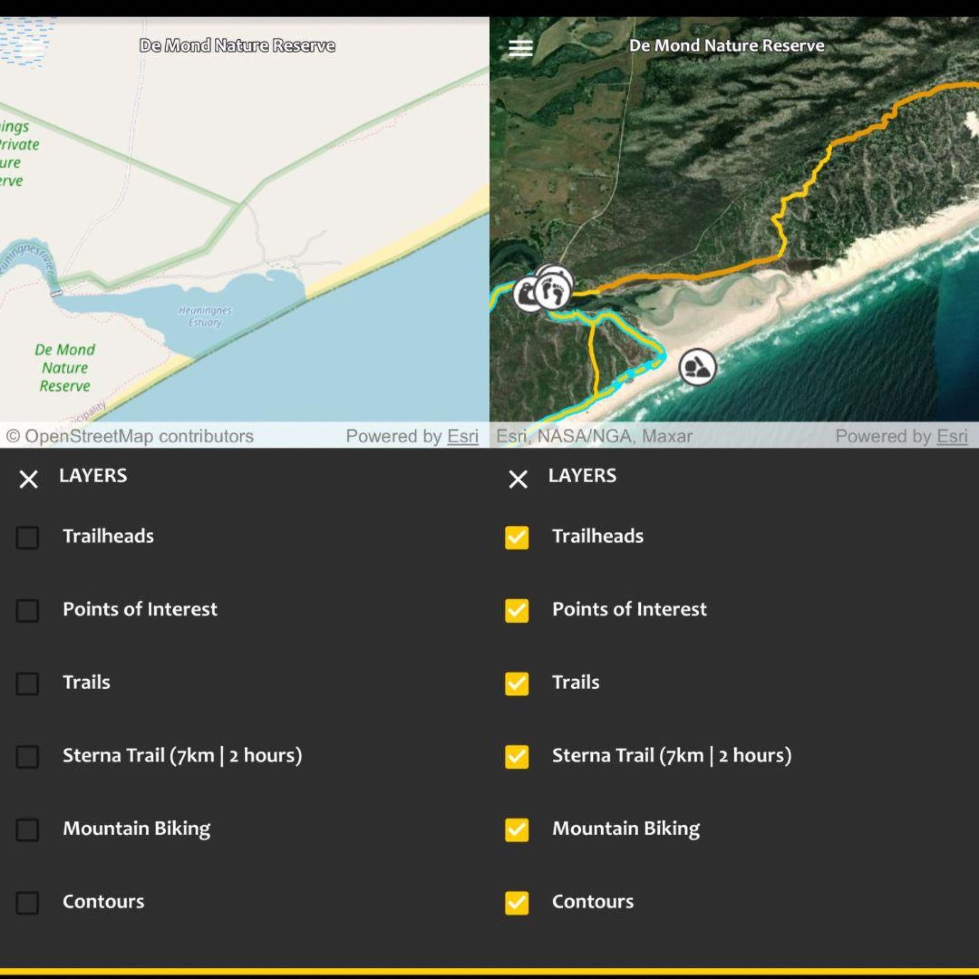
Comparision between Open Street Map basemap and Forge layers with high-definition sattelite imagery on the Forge app.
Landscapes change due to weather and natural disasters; new infrastructure is built; and trails can be closed temporarily due to maintenance or emergencies. Unlike with static paper maps and even platforms reliant on OSM, we can update our maps almost instantly to reflect changes on the ground so that you get the most accurate information to make informed and safe decisions. Since 2021, we’ve incorporated new content on the fly, including:
- Entire trails, such as the brand new overnight Damara Trail at De Mond Nature Reserve with its associated points of interest (POIs),
- New POIs, such as the Duiwelshoek Viewing Deck at Grootvadersbosch Nature Reserve,
- New accommodation, such as Bliss on the Bay in Betty’s Bay.
As CapeNature’s partner, we are in constant communication on the latest closures to reflect them on all our maps across all platforms, whether on the Forge app and website or the CapeNature website. This ensures that you can make informed decisions for your planned trips and get the most out of them while staying safe when out in the wilderness. For example;
- At De Hoop Nature Reserve, the Whale Trail is closed in February for maintenance and we reflect it as such on the map.
- Recently, at Hottentots-Holland Nature Reserve, parts of what was formerly the Boland Trail have been closed and re-routed. We are currently assisting CapeNature in communicating this via our map through closure notices and rerouting the actual trail segments on our maps accordingly.
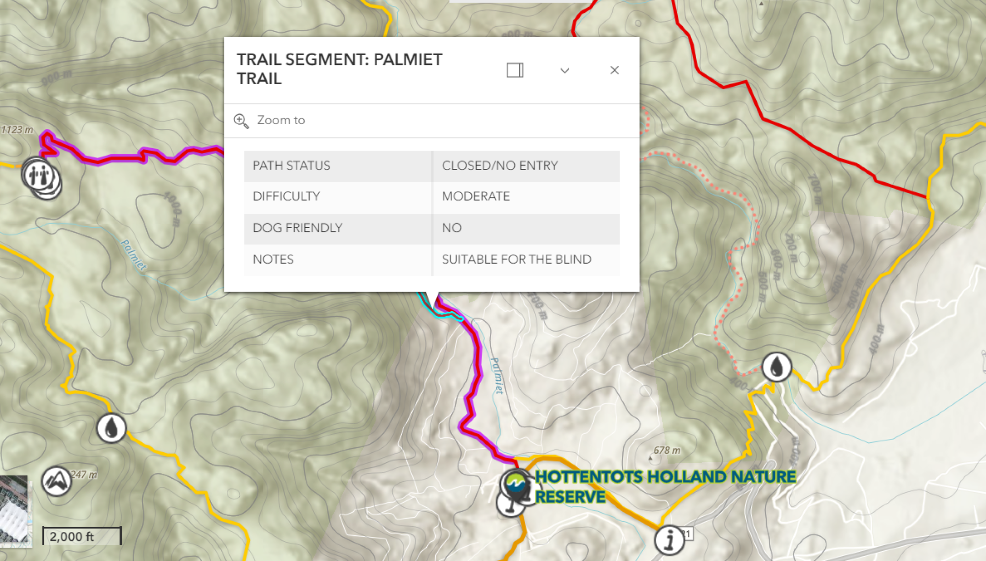
Visualising up-to-date closures helps keep you safe and informed
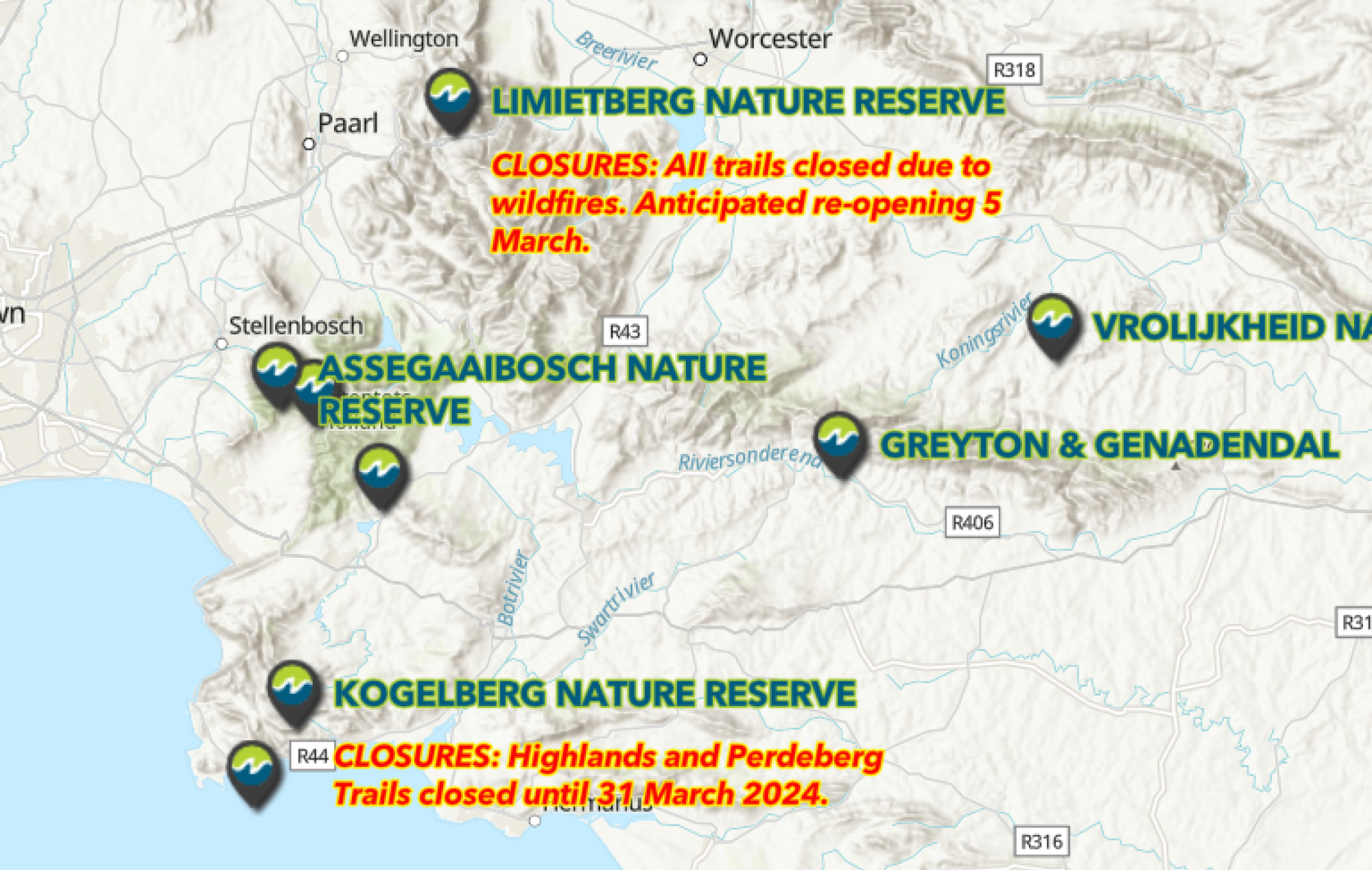
Forge is in regular contact with CapeNature to showcase major closures at each reserve which appear on Forge platforms and the CapeNature website.
Empowering you and bridging the gap between you and trail managers
The Trail Issue Alert tool embedded in the Forge app lets you play a role in conservation by being able to provide feedback on any observed issues you may come across. We relay all feedback to the relevant CapeNature personnel so that they can address it appropriately, while we update our maps accordingly too for the benefit and safety of other visitors.
Your safety is always top of mind, which is why we work with CapeNature (and liaise with Wilderness Search and Rescue as well) to verify that our localised emergency contacts on the Forge app are the correct ones so that you get the most appropriate help wherever you are.
While we don’t collect any personal information or tracking information through our platforms, we are able to gauge how often our maps are viewed, whether on the Forge app or online. We pass on this non-personal information back to CapeNature to give them an impression of which areas are most popular, how often our reliable maps are used in the field and even downloaded for offline use. This helps bolster action on the ground by informing areas that may need to be prioritised for additional conservation work, appropriate visitor guidance interventions, marketing campaigns, and more.
Quickly producing static maps with instantly available and accurate data
By virtue of having up-to-date mapping data at our disposal, we can produce printable maps at the drop of a hat.
In late 2022, the team at CapeNature asked if we could help them put together a new (big!) map signboard at the entrance of the popular Jonkershoek Nature Reserve. With specified graphic design guidelines, we were able to produce the map within just a couple of weeks. What’s more, the map includes a scannable QR code linking to the Forge app, letting you download the app on the spot so that you can take your accurate and up-to-date map with you on your smartphone and download it offline, for free!
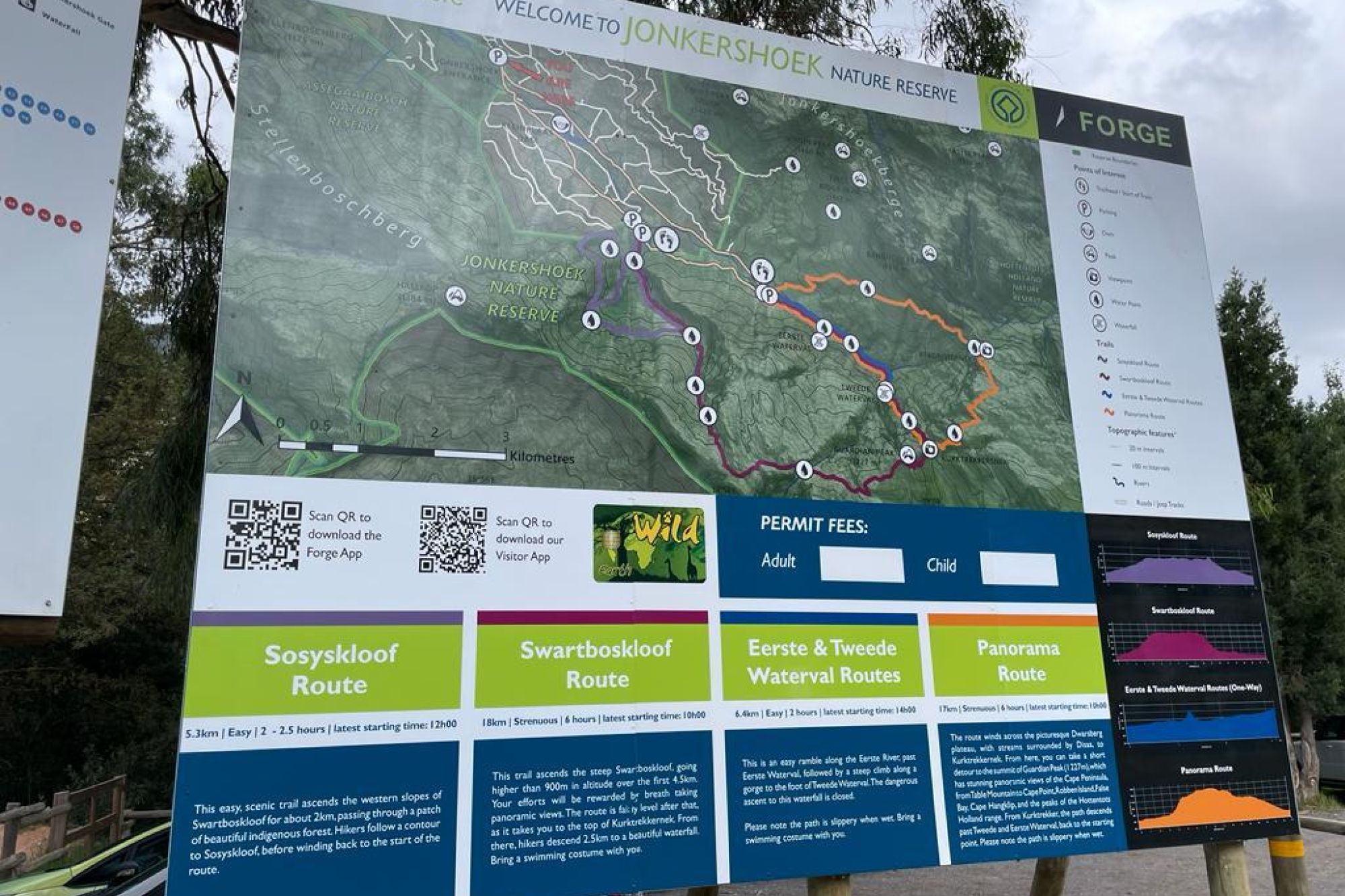
Map signboard at the entrance of Jonkershoek Nature Reserve.
We’re proud to have just created the brand new brochure/paper map for De Mond Nature Reserve in the beautiful yet informative style that you’ve come to expect from CapeNature brochures.
We use the term ‘partner’ to describe our relationship with CapeNature, as they are absolutely integral to ensuring we can indeed keep our maps as up-to-date and helpful as possible. Together with you and our built-in Trail Issue Alert tool, we are able to complete the full cycle of linking trail managers and visitors that enhances safety and enjoyment for everyone visiting the stunning array of CapeNature reserves.
As always, if you have any comments or feedback, you can get in touch with us directly via email at info@forgesa.com. Or, if you’d like to spread the love, leave us a review on your mobile app store.
Related News
How can I assist you today?
How can I assist you today?


